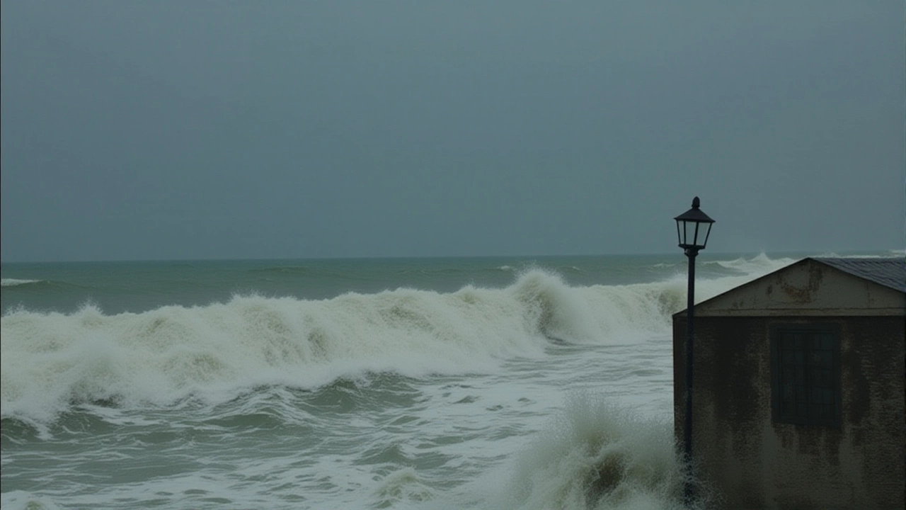
On the morning of October 28, 2025, India Meteorological Department issued its most urgent warning in years: Cyclone Mocha was poised to slam into the Andhra Pradesh coastline between Machilipatnam and Kalingapatnam, packing sustained winds of up to 110 km/h. The storm, which had been churning in the south-west Bay of Bengal since October 25, had intensified rapidly — a terrifying acceleration that caught even seasoned forecasters off guard. By 6 a.m. on the 28th, it was classified as a severe cyclonic storm, and by evening, meteorologists feared it could become an extremely severe system. Coastal villages were already losing power. Trees bent like reeds. The sea, usually a quiet neighbor, had turned into a roaring, brown wall.
Who’s in the crosshairs?
The red alert issued by the India Meteorological Department stretched across five states: Andhra Pradesh, Odisha, West Bengal, Chhattisgarh, and parts of Tamil Nadu. But the real danger zone? The low-lying coastal districts. In Odisha, eight districts — Malkangiri, Koraput, Nabarangpur, Rayagada, Gajapati, Ganjam, Kandhamal, and Kalahandi — were under a red alert for rainfall exceeding 90 mm per hour. In West Bengal, 14 districts including Purulia, Bardhaman, Darjeeling, and Malda were told to expect torrential downpours through October 31. Even inland, the rain was relentless. In Chhattisgarh, rivers began to swell as floodwaters from the Eastern Ghats funneled toward the Bay.
The storm’s path — and why it’s so dangerous
At 8 a.m. on October 27, Cyclone Mocha was moving northwest at 13 km/h — slow enough to linger, fast enough to gather strength. Its eye, still forming over open water, was surrounded by towering thunderheads that stretched 15 kilometers into the stratosphere. What made this storm different wasn’t just its wind speed, but its size. Satellite imagery showed a broad circulation spanning over 500 kilometers — meaning the destructive winds weren’t confined to a narrow band. The rain bands stretched hundreds of kilometers inland. By the time it made landfall, it wasn’t just a coastal threat — it was a regional catastrophe in the making.
Experts compared it to Cyclone Fani in 2019 — but this one was bigger, wetter, and hitting a more densely populated stretch of coast. “Fani was a narrow punch,” said Dr. Arun Mehta, a former IMD scientist now with the National Centre for Medium Range Weather Forecasting. “Mocha is a sledgehammer.”
Emergency response — and the human cost
By October 27, the National Disaster Response Force had pre-positioned 47 teams across the affected states. The Odisha State Disaster Response Force had already evacuated over 120,000 people — many from fishing hamlets where homes were made of tin and bamboo. In a striking act of solidarity, the Odisha government opened shelters for 100 fishermen from Andhra Pradesh whose boats had been swept out to sea. “We didn’t ask where they were from,” said a relief officer in Puri. “We just asked if they were breathing.”
Schools in 18 districts shut down. Over 200 train services were canceled, including the Howrah-Chennai Express. Power lines in Visakhapatnam and Srikakulam were already down by midday on the 27th. In Chennai, the rain started early — not as a warning, but as a prelude. Residents reported hearing the wind howl like a wounded animal. “It sounded like the sky was tearing,” said Priya Nair, a schoolteacher in Tindivanam.
What happens next?
The storm is expected to weaken slightly after landfall, but its remnants will push deep into central India. By October 30, heavy rain could trigger landslides in the Eastern Ghats and flood low-lying areas of Jharkhand and southern Bihar. The real danger isn’t just the wind — it’s the water. The IMD predicts cumulative rainfall of 250–350 mm in the worst-hit zones. That’s more than a month’s average rain in 48 hours.
Recovery will take months. Fishing communities — the backbone of coastal economies — could lose their entire season’s catch. Rice paddies in Ganjam and Gajapati are already underwater. Farmers in Chhattisgarh are bracing for crop failure. And with the monsoon season officially over, there’s no buffer left.

Why this storm matters
This isn’t just another cyclone. It’s a symptom. The Bay of Bengal is warming faster than almost any other ocean region. Sea surface temperatures in October 2025 were 3.2°C above the 30-year average — the highest ever recorded for this time of year. Cyclones are forming more frequently, intensifying faster, and holding their strength longer. Mocha didn’t just appear — it was incubated.
Climate scientists warn that if global emissions continue unchecked, such storms could become the norm by 2030. “We’re not just dealing with weather anymore,” said Dr. Renuka Chaudhary of the Indian Institute of Science. “We’re dealing with climate rupture.”
Frequently Asked Questions
How does Cyclone Mocha compare to previous cyclones in the Bay of Bengal?
Cyclone Mocha is the strongest system to threaten the Andhra-Odisha coast since Fani in 2019, but its size and rainfall potential exceed Fani’s. Unlike Phailin (2013), which made landfall as a very severe cyclone, Mocha intensified rapidly in just 48 hours — a trend consistent with warming sea temperatures. Its wind speeds (up to 110 km/h) and broad circulation (500+ km) mean more areas will be affected for longer.
Which areas are at highest risk for flooding?
The low-lying coastal districts of Ganjam, Gajapati, and Koraput in Odisha, along with Purulia and Bardhaman in West Bengal, face the greatest flood risk due to saturated soils and poor drainage. Inland, the foothills of the Eastern Ghats in Chhattisgarh and northern Andhra Pradesh are vulnerable to flash floods from runoff. IMD data shows over 200 villages in these zones are below the 10-meter contour line.
Why was a red alert issued for Chhattisgarh, which isn’t coastal?
Although Chhattisgarh has no coastline, it lies directly in the path of Mocha’s inland moisture plume. The storm’s circulation draws in humid air from the Bay, which then dumps heavy rain over the region’s hilly terrain. IMD recorded rainfall exceeding 120 mm in Raipur within 12 hours on October 28 — a record for October. This poses serious landslide risks in the Bastar and Surguja districts.
What’s being done to protect fishermen?
The Indian Coast Guard evacuated over 800 fishing boats from the open sea before the storm hit. In Odisha, 15 temporary shelters were set up near the coast with food, clean water, and medical kits. Fishermen from Andhra Pradesh who were stranded at sea were brought ashore by SDRF boats and housed in schools converted into relief centers. The government has pledged ₹20,000 per affected fisher household for immediate relief.
Will power and communication be restored quickly?
Not immediately. In areas where winds exceeded 100 km/h, transmission towers were toppled and underground cables flooded. The power ministry estimates 60% of distribution networks in coastal Andhra and southern Odisha are damaged. Restoration could take 7–10 days. Mobile networks in Ganjam and Gajapati are already down. Emergency satellite phones are being distributed to district headquarters.
Is this storm linked to climate change?
Yes. Sea surface temperatures in the Bay of Bengal reached 31.8°C in October 2025 — the highest ever recorded for this month. Warmer water fuels faster intensification. Since 2010, the number of cyclones reaching severe or higher intensity in the Bay has increased by 40%. Mocha is the fifth such storm in 18 months — a pattern scientists say is no longer coincidental.